Buy map at Geodus.com: map UK, London map, map world, map multi.Geodus Karten in DeutschGeodus carte géographique en français
Best Service DetailsView Cart
Globes Maps
Buy maps at Geodus. Contact Customer Service

Group by:
Geo-zones
Choose your zone on the right
Map types
antique
children
designer
satellite image
3D
political
physical
ground-vegetation
relief-forms
economic
climatic
outline
poster
Brands
National Geographic
Klett-Perthes
Columbus
Terra
Albedo39
Antica
Future Mapping Co.
MBM Systems
Planet Observer
Ray & Co.
Map sizes
M medium
L large
XL extra-large
Price Range
0€ - 20€
20€ - 50€
+ de 50€
Super Sale
The Geodus Sales


Best Service Details
Free Shipping over 30 € (3.50 € else)
Happy or money back !
30 000 items in stock
Geodus refunds you the difference if you find the same article (new one) in Europe cheaper, on the web (schipping costs included) or in a shop, within a period of 2 weeks after payement (See conditions of use for more details).
  The Geo-zones :
World maps
View world maps

World


World Children
World Designer
View Item | View world maps
 
Continent maps
European maps from Klett-Perthes

Europe

Africa
America
Asia
Australia
View Item
Country maps
UK map from Klett-Perthes
UK-Ireland

China
France
Germany
Spain-Portugal
USA or United Staes

other countries
View Item | View country maps
 
Regional maps
Map of Kent & Thames Estuary from Planet Observer


Maps of UK regions

Maps of Austrian regions
Maps of German regions
Maps of Italian regions
View Item
Town maps
Map of London from Klett-Perthes


London

Berlin
Paris

other towns


View Item | View town maps


1. A map consists of a representation of a geographic zone (geo-zone), applied on a support.
2. Some maps are printed on both sides; one map on the front side, a second on the back side. They are pointed out by the "2 maps" sign.
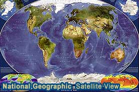
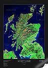
4. To choose a map, first select the geographical zone (geo-zone); world map, continent map (ex:Europe), country map, ...
5. A map may represent the countries (type: political map), the mountains and plains (type: physical map or relief-forms), the forests and the deserts (type: ground-vegetation map) or only the outlines (type: outline map). World maps may also be from economic or climatic type. There are also world maps for children or designer maps.
6. Most of our multi-country maps (world maps, continent maps) are available in a variety of languages; you can make your choice on the item page. The mono-country maps are, in general, only available in the country language (language=local). For example, the France map exists only in french.
7. Different map sizes are, in general, available for a given zone (ex: Africa physical map, 1.55m (61'') x 2.05m (81'') or 1.16m (46'') x 1.46m (57'') ). The relative size pictograms allow you the evaluate the size of the maps.
8. Many of our maps are available on 2 different supports; paper or laminated (writable and cleanable). You can choose the variant on the item page.
9. All of our maps are top quality products and are guaranteed.
10.Discounts are possible for large orders. Please contact us.
Contact Customer Service

My Order
How can I pay ?
Where is my order ?
Guarantee & Returns
Guarantee
Returns
The Geodus company
About us
Secure Payment.

- To get our newsletter, please enter your mail:

Privacy Policy | Conditions of Use | Site Map | Links | Contact Us
buy world globes in UK | buy world globe in the U.S.

Copyright © 2005-2007 by Glegl